Single Carriageway (some undivided) : 77.8 km (0 km by 2031)
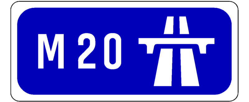
The N20 connects Ireland's second largest city with its third largest - Cork to Limerick.
In the 2000s, when major upgrades of all trunk roads in Ireland were planned, this road suffered the unfortunate distinction of being, along with the N18 and the N9, the national primary route serving a city that was in most need of urgent attention.
However, the M9 and M18 have replaced those other roads, but still the N20 has not been improved.
The road starts on the quaysides of the River Lee in Cork City, following city streets out of the city.
An urban bypass of the suburb of Blackpool opened in April 2001, linking to the dual carriageway that runs as far as Blarney with its much-kissed stone.
From here, some parts of the road are in a 2+1 lane configuration, a rare sight in Ireland.
This takes the motorist as far as Mallow, which is not, incidentally, located in a marsh.
The upgrade of this section of the route will mainly consist of widening the existing road, since it is already up to a high standard.
Sadly the existing route goes steeply downhill in quality after this.
Mile after mile follows of poor quality, winding road which could only be described as a country lane.
This goes on for nearly 40 kilometres, passing through a bona fide chicane at Buttevant, the scattered town of Charleville, and countless small villages with bizarre names like Lackanalooha, Garrycummer, Imphrick, Shinanagh, Knockaunavoddig and Newtwopothouse.
The motorway replacement will be like stepping directly from the 19th to the 21st centuries.
Finally, the Croom bypass is reached.
In 2001 a grade-separated single carriageway road (rare in Ireland) opened which will form the basis of an upgrade in the future.
From here, it's a short hop to the N21/M20 junction and the motorway up to Limerick.
This section opened as dual carriageway in July 2001 and was redesignated motorway in August 2009.
It is Y-shaped with the M20 coming south from Limerick, then splitting with the N21 continuing southwest and the N20 veering south.
At the point where the M20 reaches the M7 Limerick Southern Ring Road, there is a large freeflow junction.
The entire route from the M20/N21 junction south to Cork will be replaced with a new M20 motorway.
This has been cancelled and reactivated many times but as of 2018 it is back on and included in the new National Development Plan.
It was anticipated to start construction in 2023 and open to traffic in 2026.
At the Cork end, a related project is the Cork Northern Ring Road, which will connect the new motorway from somewhere south of Blarney to north of Glanmire.
It is likely that the remainder of the road into Cork city centre will be renumbered at that stage, so the M20 will finish at the M20/Cork Northern Ring Road junction.
As of 2026, however, a planning application had still not been submitted.
Update 12/07/2019:
The M20 from Limerick to Cork is at Feasibility Study. It is cautiously pencilled in for completion by 2027.
Update 22/11/2020:
Route options have been published.
These are mostly east of the existing N20.
Options for the potential rail improvements are on page 8 and include an upgrade of the existing rail lines, and the building of short segments of new line to make a shorter route.
Update 05/10/2021:
The following update was taken from the NDP accompanying documentation and is courtesy of Boards.ie:
"The N20 road corridor options are currently being progressed with Public Transport (Rail) alternatives as comparators.
The scheme is currently at Route Options Selection stage where all the road and rail options will be considered, with the preferred transport corridor expected to be announced by the end of 2021 [note: now expected Q1 2022].
Subsequent to this, work on scheme design and environmental evaluation will be undertaken, in addition to the scheme Business Case, which is required under the Public Spending Code (PSC).
The scheme Business Case is expected to be submitted to DPER in early 2023.
Subject to its approval, the submission of the statutory documents for the project to An Bord Pleanála (ABP) will follow thereafter."
Update 03/04/2022:
The preferred route corridor for the M20 Limerick-Cork motorway has been announced.
The details are on the official scheme web site.
The document showing the maps is here.
A TD has tweeted the announcement including a map of the proposed scheme.
The route corridor right now is 500 metres wide.
Since only a small part of that will actually be required, even if the current route appears over a particular property this does not necessarily mean that the property will have to be acquired.
The details of this will be worked out in future project phases.
A detailed description of the path the road will follow is here, reproduced from the scheme brochure:
"The preferred option commences just south of the Blarney junction and remains largely online to maximise the reuse of the N20 until it diverges eastward near Mourneabbey.
Remaining to the east of the N20 it crosses the River Blackwater, the N72, the N73 and the River Awbeg as it bypasses to the east of Mallow and Buttevant until it converges with the existing N20 north of Buttevant.
It then remains close to the N20 until it diverges westwards near Ballyhea, bypassing to the west of Charleville, before re-joining the N20 south of Croom.
The preferred option reuses the N20 Croom Bypass and then diverges at Garranroe and
runs west of the existing N20 until it reaches its tie in point with the existing M20/N21 at Attyflin."
Additionally the preferred option for the rail improvements between the two cities has been announced.
The plan is to utilise the existing rail corridor but to eliminate the need to change trains at Limerick Junction and increase the linespeed.
A missing movement will be added at the junction to allow trains to travel between Limerick and Cork without the need for passengers to disembark and change trains.
Separately there was a long term plan to double-track the Limerick to Limerick Junction segment but seemingly this work will not take place at this time.
Update 24/09/2023:
The new motorway between Cork and Limerick is still expected to start construction in 2027 and be completed in 2031, and to cost north of €1 billion.
It is also heartening to see the cost confirmed in the billion euro range, after it was erroneously stated by the Minister for Transport Eamon Ryan that the project could cost up to 3 billion.
The M20 will likely be the last motorway built in Ireland, or at least the last with a significant length.
The exact start and end points are Patrickswell, Limerick and Blarney, Cork (with its famous stone), giving the new road a length of 75-80 km.
Update 01/12/2023:
The future corridor of the M20 Limerick-Cork motorway has been refined, with the width now 200 metres. It will be further reduced next year. The location of interchanges for Mallow and Charleville is also being finalised now. It is expected that a planning application will be lodged by the end of 2024. The most recent timeline for construction is from 2027-2031. This new road is badly needed as with 17 fatalities between 2011 and 2018, that makes around 2 deaths a year and 4 serious injuries. The official announcement on all this is here.
Additionally there will be rail improvements:
Iarnrod Eireann has also been asked to consider a "no change hourly service" between both cities in an effort to improve rail links, which it is believed will increase demand for train transport to and from both locations.
All of this can be seen on the scheme website by clicking Interactive Mapping.
Update 27/02/2024:
Preliminary business case for the motorway project is due to be submitted in late 2024.
Here is more info.
Update 16/04/2024:
Leo Varadkar resigned as Taoiseach recently and has been quickly replaced by Simon Harris who now takes over as Irish Prime Minister.
He seems to be making his views on road investment clear with a pointed statement about how he urgently wants an update on the M20 Cork-Limerick motorway project, currently due to start construction in 2027. The Minister of Transport is from the Green Party and has expressed a lack of interest in building "big roads" so the Taoiseach is nailing his colours to the mast:
Mr Harris said he is a "big believer" in continued investment in the road network.
"I signed up to a Programme for Government that is anti-carbon, not anti-car; a Programme for Government that recognises that we all need to change how we live - we get that, we get the climate emergency, we absolutely need to continue to improve our public transport and I commend the work of Minister (Eamon) Ryan in relation to that but we also need to continue to invest in our road network," he told reporters.
"I'm very conscious of the fact that in the Department of Transport now, there are very many large capital projects and that is a good thing. I will certainly be seeking an urgent update in relation to the M20 and engaging with my colleagues here (in Limerick). I haven't had that opportunity yet to sit down and talk to Minister Ryan in relation to it but from the point of view of Fine Gael in government, continuing to invest in our road network."
The Taoiseach said such investment is important from a safety point of view but also in terms of the transition to electric-power vehicles. "Where are we going to put these electric vehicles? We do need to actually have good safe roads to put them on so I don't think it's a question of 'is it public transport or is it roads?' - It's a question of investing in our infrastructure overall."
The article also explains that the project is due to come before Cabinet by the end of the year and a planning application will be submitted thereafter.
Update 30/06/2024:
A much anticipated M20 update has been put out by the government on the corklimerick.ie website.
This has been reported by the media, including this Irish Times article, but the Irish Independent piece confusingly makes it sound like the cycle lanes will be on the motorway, which of course would be against regulations (they will instead be on parallel routes that pass through the settlements served).
Here in full are the details that have been made public:
Dual carriageway M20 motorway with a 120kph speed limit selected, following detailed appraisal of alternative road types. The M20 motorway will be five times safer than the current N20 single carriageway and reduces intercity journey times on average by 30 minutes.
As the largest single active travel project to be undertaken in Ireland, the project will provide up to 100km of safe, shared active travel pathways connecting communities from Blarney to Patrickswell and encourage walking and cycling for work, school, and leisure, linking communities, promoting healthier lifestyles, and reducing transport emissions.
The location of Transport Hubs identified for Rathduff, Mourneabbey, Mallow, Buttevant, Charleville, Bruree and Croom. These transport hubs will feature park & ride facilities for public transport, park & share, EV charging, and will be connected to local communities with the new active travel network.
A Freight Hub in Mallow will provide facilities for parking, welfare and EV charging for heavy goods vehicles in accordance with European and National transport policies.
The project will facilitate efficient public transport options, including the opportunity for quicker intercity express bus services and improved efficiency on existing bus services serving the communities between Cork and Limerick.
To improve existing infrastructure, the project will utilise over 60% of the existing N20 road corridor for developing the dual carriageway motorway or reallocation of existing road space for the new active travel infrastructure.
The project team continue to incorporate best practice for environmental, biodiversity and carbon management.
To encourage sustainable transport choices, support Ireland's climate action plan, and to support the maintenance and renewal of the new transport infrastructure, the project team has recommended demand management measures. These measures include distance based barrier free tolling, whereby users pay on the basis of distance travelled on the new M20 motorway. Work is ongoing to determine appropriate toll charges for the various classes of vehicles, balancing a number of different factors, including the project objective to remove strategic traffic, especially heavy goods vehicles from the communities along the existing N20 to maximise safety and environmental benefits.
Note that previously the Minister for Transport Eamon Ryan stated that he intended to lower the standard to which this road would be built, making it a reduced width dual carriageway with lower standard junctions.
It is now confirmed that this will thankfully not be the case.
The transport hubs are a welcome addition as they will provide a place for carpooling, EV charging and bus stops.
The freight hub at Mallow with facilities for HGVs is a first for the country.
Normally active travel and public realm improvements in bypassed towns have to be undertaken by the relevant county council, so it is good news that these improvements will be made as part of the project on this occasion.
The reference to 60% of the existing corridor being reused refers to the fact that the Blarney-Mallow section and Croom bypass are already built in recent decades to a high standard and will simply be reformed into a motorway.
Only the rest of the scheme will be a new offline build.
Barrier-free distance based tolling will be a first for this country.
The M50 has barrier free tolling, but it is still single-point.
Other motorways have multiple point tolling but it is never distance based.
It has not been revealed what the toll rate per kilometre would be, though France charges €0.10/km.
At this rate, the new 80 km of motorway would cost 8 euro to travel in full, a fair bit higher than other Irish motorways cost.
The final design and "fence line" (showing the exact amount of land the new road will require) will be published at the end of this year.
The planning application is expected in 2025 with construction following in 2027.
All going according to plan, the road would then open in 2031 but it may be delivered sectionally.
The scheme website has made far more detailed information available on a different page.
If you scroll to the bottom, you can find links to an overall scheme map, detailed design maps, and a promo video which seems to be the same as one they posted before.
Update 21/06/2025:
A design update has appeared on the M20 official web site corklimerick.ie and includes more detailed maps of the route - the links are at the bottom of the page.
The maps can also be accessed directly from this page - look at the "Drawings".
"If planning consent is granted, the project will be constructed in phases, with traffic flow gains being achieved through the construction of by-passes of Charleville, Buttevant and Mallow initially.
Dependent on the approval and planning process, construction of the project could begin in 2028. It is estimated that the project will take approximately seven years to fully complete."
From the above, it seems that the central continuous section from Mallow-Charleville will be done first, with Mallow-Blarney and Charleville-Patrickswell coming after.
This is because "by-passes of Charleville, Buttevant and Mallow" need to consist of complete sections from junction to junction and these 3 towns follow one after the other.
The scheme will provide 80 more kilometres of road (complementing the already completed section near Limerick) and offers a 40 minute journey time for cars and light good vehicles.
It will feature distance-based barrier-free tolling. It seems it will be built in 4 separate contracts and a planning application will be submitted by the middle of next year.
The media have also reported on the project.